Standoff with the Montana Freemen
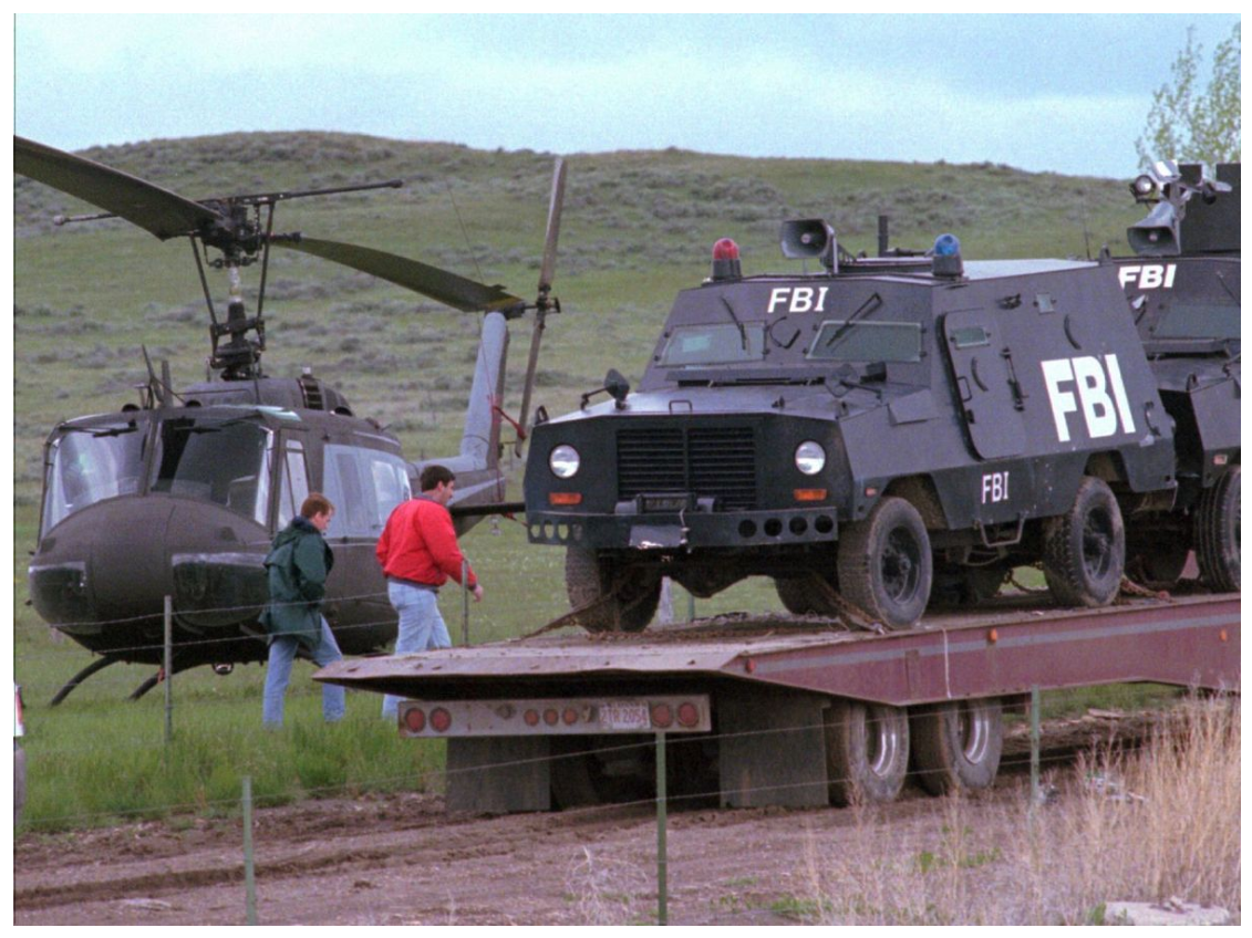
On March 25, 1996, an 81-day standoff began between FBI agents and an anti-government group known as the Montana Freemen. The standoff continued until the last members of the Freemen surrendered on June 14, 1996.
The group, which had become increasingly frustrated by the government in the midst of foreclosure proceedings on the property near Jordan on which they gathered, began holding mock trials of public officials and filing claims against officials, private citizens and journalists.
The situation was the third major armed standoff involving federal agencies in the 1990s, after the 1992 incident at Ruby Ridge, Idaho and the 1993 siege of the Branch Davidian compound in Waco, Texas, both of which ended in multiple casualties. The Freemen standoff produced only one casualty, when FBI Special Agent Kevin Kramer rolled the Ford Bronco he was driving along a dirt road leading to the Freemen farm and was ejected from the vehicle. Kramer died later at a nearby hospital.
Members of the Freemen were tried for various offenses, including bank fraud, mail fraud, making threats against public officials (including a judge for whom they wrote a writ of execution) and the armed robbery of an ABC News television crew in October, 1995.
Also in March 1996
President Bill Clinton approved a comprehensive national policy on the future management and use of the U.S. Global Positioning System (GPS), making the technology available for civilian use. Previously, the primary purpose of GPS was enhancing the effectiveness of U.S. and allied military forces. Both Garmin and Magellan immediately introduced hand-held GPS units for the civilian market.
At that time I was teaching outdoor courses (map reading, wilderness survival, etc) for a chain of outdoor stores in Arizona called Popular Outdoor Outfitters. They told me I needed to learn how to use GPS right away because they would be selling the new devices and wanted me to offer courses. I had been an instructor in the Army and received several commendations for teaching land navigation. MGRS (Military Grid Reference System) and UTM (Universal Transverse Mercator) are very similar so I had no trouble learning and teaching GPS.
May 1996
Not sure how, but word spread that there was a GPS instructor in Phoenix, Arizona. I was contacted by the FBI about training agents who were involved in a standoff near Jordan, Montana. Small teams of agents arrived for training, then headed back to Montana.
Not surprising to me, a government purchasing agent used some criteria other than common sense when purchasing GPS units for the agents. The civilian Garmin or Magellan units would have been a safe bet, but instead the agents arrived with units capable of only one function — provide a grid coordinate. There was no “go to waypoint” feature. By necessity the instruction included plotting the grid coordinate delivered by the GPS unit to a 7.5 minute topographic map, plotting the desired destination on the map, then using a good old fashion compass to follow the bearing.
Really enjoyed training the teams and found myself more interested in the news story than I would have been otherwise.