Search by Keyword

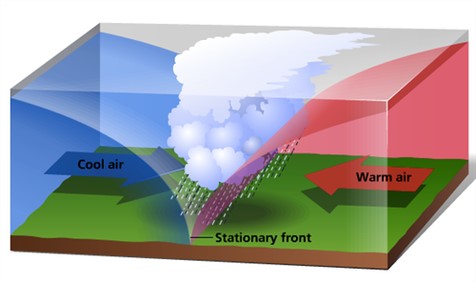
Linked below are two videos describing different types of frontal systems and the kind of weather each is likely to bring. Add cloud recognition to the mix and you have more tools for predicting changes in weather.
Warm fronts are likely to form stratus clouds. Cold fronts are more likely to form cumulous clouds.
NIMBOSTRATUS CLOUDS
Nimbostratus clouds are low-level rain clouds that form a uniform layer. These layers cover the sky, producing overcast conditions, and uniformly extend in all directions. They are dark in color and produce steady, prolonged precipitation. They represent a strengthening and thickening of a stratus cloud layer. While stratus clouds are renamed nimbostratus when precipitation becomes significant, stratus clouds themselves can produce occasional, light precipitation.
CUMULONIMBUS CLOUDS
Cumulonimbus clouds are large, puffy clouds with strong vertical development. They are formed by the upward movement of warm, moist air. In their mature stage, they also produce strong downdrafts of cold air. Cumulonimbus clouds are considered low-level clouds, even though their vertical development may extend high into the atmosphere. These clouds produce intermittent, intense precipitation and are associated with severe weather. Strong cumulonimbus storm cells can produce thunder, lightning, hail, torrential rains, strong winds and tornadoes. Cumulus congestus clouds, having more vertical development than fair-weather cumulus clouds, can also produce light rain, though not significant enough to warrant a name change to nimbus.

